
An art gallery in Chester, Connecticut, a scenic little town if there ever was one, (http://chesterct.org/) is going to be showing a piece of my art soon. The gallery is Maple and Main http://www.mapleandmaingallery.com/, the show is Imaging Chester (http://www.mapleandmaingallery.com/imaging-chester) and my piece is called...wait for it...
Six Ways of Looking at the Pattaconk Brook. The title is a bit of sideways homage to the poem, "Thirteen Ways of Looking at a Blackbird," by Connecticut poet Wallace Stevens.
I chose to focus on the Pattaconk Brook because it's a watercourse flowing throughout Chester, and because I I liked its name. According to the town website, chesterct.org/about-chester/, Pattaconk is an American Indian term referring to a round or wigwam-shaped hill, possibly as the town of Chester appeared when viewed from the Connecticut river.
A few days ago, Joe and I drove down there--Chester is south and east of where we live in West Hartford--to look for scenic Pattaconk shots.
But first, a fun fact: Having studied Latin for five years, I can tell you that any place in England with Chester in its name derived that name from the Latin word castrum, meaning a camp or settlement...that is, a Roman outpost in the British Isles. The word castrum developed into the word chester and then was transplanted from England to the new world. So here we have Chester, Connecticut, which is in no way a former Roman settlement. Instead, it was an English settlement in the territory of the Wangunks, a river tribe of native Americans.
Joe and I knew that mid-December wasn't going to yield anything like this idyllic view of the Pattaconk Brook shot by Connecticut photographer Kyle Nolin http://www.imgrum.net/user/spngewrthy/6738926/1163028429696490822_6738926

. . . but we hoped to find the place on the ground that corresponds to the location of these satellite photos, courtesy of Google Maps:


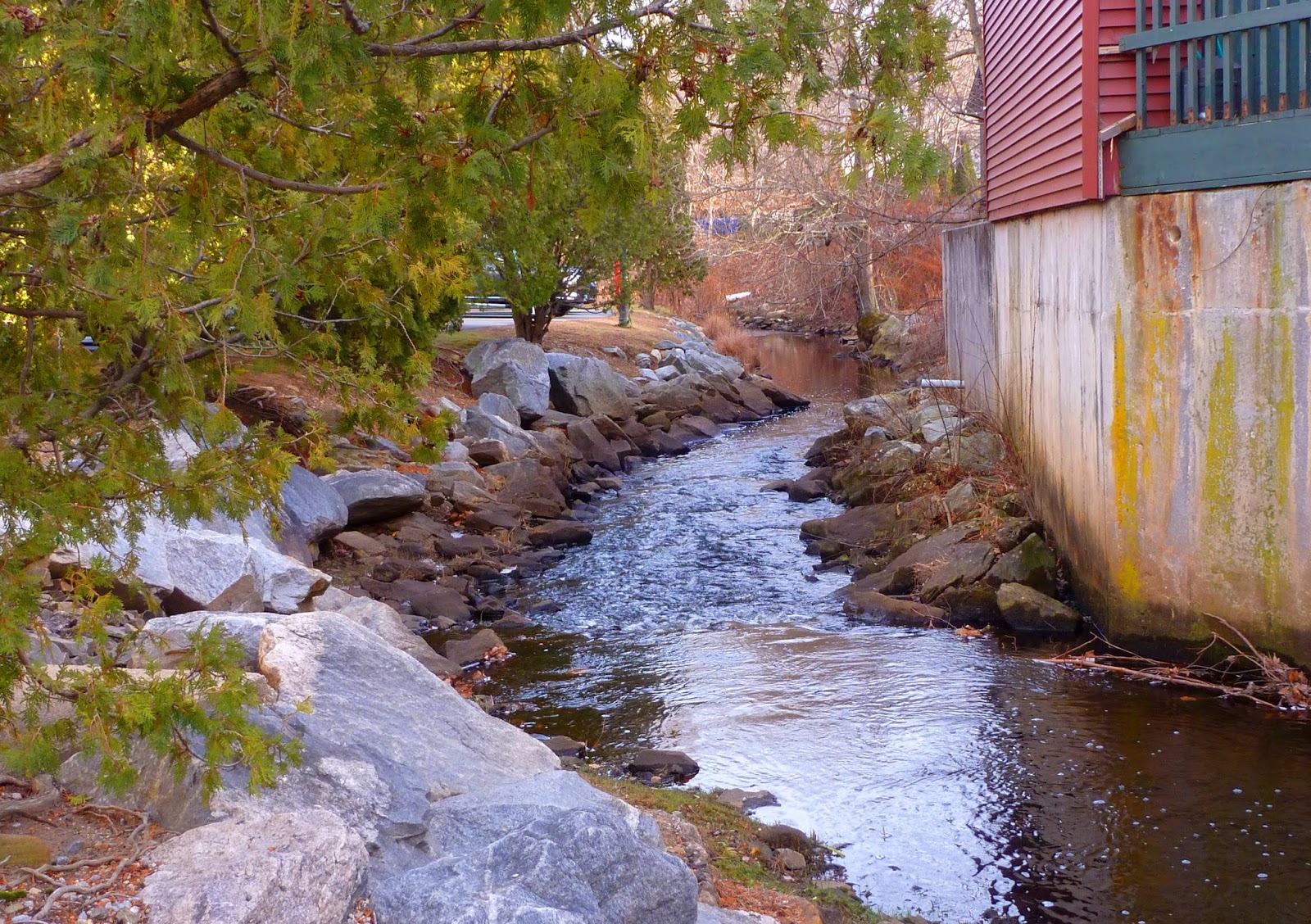
Instead, the Pattaconk we saw at ground level was more like this:


Kind of bleak, don't you think?
From the map, it looks as if the Essex Steam Train, http://essexsteamtrain.com/about/ a vintage railroad tourist attraction, actually provides the closest ingress to some of those paludal areas. Take a look at this map and you'll see the railroad route ambling right along the river, close by to where the Pattaconk forms those marshy areas before traversing through the Pattaconk Yacht Club http://www.pattaconk.org/and emptying into the Connecticut: http://essexsteamtrain.com/about/river-and-rail-map/
And thanks to Sister Mary Immaculata, M.Z.S.H., my high school Latin teacher, for explaining that the Latin noun palus, (paludis) meaning a swampy area, has a cognate in the English adjective paludal, meaning "of or relating to swampy areas." I've never heard that word uttered outside her class, except by myself.
Despite the paludal areas, Joe was able to get a couple of good shots of the brook, like this one somewhere along Dock Road in Chester. Can you believe that this, and the photo above, are as close as we could get to the beguilingly sinuous watercourse in the satellite photos?

But how about this one, another shot by Joe, where the brook goes through the middle of the town:
Later, after we returned home, I found a contour map of the town:

and another satellite view:

In all, I came up with six different ways of looking at the Pattaconk Brook. Thanks to the ability to print photos on fabric, http://www.dharmatrading.com/transfers/print-on-cotton-packs-of-6-sheets.html?lnav=transfers.htmlI'm about to turn them into an art quilt.
I'll show you when it's ready.
Betcha can't wait!